
Drone Services for Real Estate: Elevating Your Property Marketing
- lucas simmons
- Sep 18, 2025
- 14 min read

A New Perspective in Property Marketing

Drone services for real estate are changing how properties are marketed and sold. These aerial photography and videography services capture stunning overhead views that showcase properties from angles impossible with traditional ground-level photography.
Key drone services for real estate include:
Aerial Photography - High-resolution images showing property boundaries, layouts, and surroundings
Aerial Videography - Cinematic fly-through tours and dynamic property showcases
Virtual Tours - Immersive experiences combining aerial and ground-level footage
Property Mapping - Detailed site surveys and boundary documentation
Construction Progress - Time-lapse documentation for developments
The impact on real estate marketing is dramatic. Listings with drone photos and videos receive 68% more views than those without, according to industry research. Properties marketed with aerial media also sell 47% faster than traditional listings.
This change comes at the perfect time. With 90% of home buyers using online resources to find properties, visual content has never been more critical. Drone footage answers key buyer questions about property size, layout, and neighborhood context before they even schedule a viewing.
Professional drone services have evolved far beyond simple overhead shots. Today's providers offer cinematic video tours, detailed property mapping, and sophisticated editing that creates compelling visual stories. Whether you're marketing a luxury estate, commercial property, or standard residential listing, aerial perspectives add sophistication and help properties stand out in crowded markets.
This guide will walk you through everything you need to know about drone services for real estate - from understanding the core benefits to choosing the right provider and integrating aerial content into your broader marketing strategy.
The Best Benefits of Aerial Imagery

Picture this: you're scrolling through dozens of property listings online, and suddenly one stops you in your tracks. It's not just another ground-level photo of a front door – it's a breathtaking aerial view that shows the entire property, its stunning pool, and how it sits perfectly in the neighborhood. That's the power of drone services for real estate.
We're living in an age where first impressions happen in seconds, not minutes. When potential buyers are clicking through endless listings, aerial imagery doesn't just catch their eye – it holds their attention and makes them want to know more.
The numbers tell the story beautifully. Properties with drone photos and videos don't just look better; they perform better. We're talking about a strategic investment that leads to faster sales and often higher offers. Let's explore why smart agents and sellers are making aerial imagery an essential part of their marketing toolkit.
Create a Powerful First Impression
In today's digital world, you have about three seconds to grab someone's attention as they browse listings online. That's where drone photography becomes your secret weapon.
Increased listing views happen almost immediately when you add aerial content. There's something magical about seeing a property from above that makes people stop scrolling and start dreaming. Instead of wondering "how big is the backyard?" or "what's the neighborhood like?", they can see it all in one stunning shot.
The sophistication and professionalism that drone imagery brings to your marketing materials is undeniable. Whether you're creating online listings, printed brochures, or social media posts, aerial visuals instantly lift your brand. They signal that you're using the best tools available and taking the marketing seriously.
But here's what really matters: standing out from the competition. While everyone else is showing the same front-door-and-living-room photos, your listing features a cinematic aerial tour that showcases the property's true personality. It's the difference between blending in and being memorable.
Want to see what we mean? Watch a sample drone video and experience how aerial footage transforms a simple property tour into something that feels like a movie trailer for someone's dream home.
Showcase the Complete Property Story
Here's where drone services for real estate really shine – they tell the whole story, not just part of it. Ground-level photos are great, but they're like reading every other page of a book. You miss the big picture.
Property scale and layout become crystal clear from an aerial perspective. Suddenly, buyers can see exactly how that three-car garage relates to the main house, or how the guest cottage sits on the back of the property. For larger estates or properties with unique architectural features, this bird's-eye view is invaluable.
Think about all those unique features that are hard to capture from the ground. That gorgeous swimming pool might look nice in a regular photo, but from above, you can see how it's perfectly positioned to catch the morning sun while maintaining privacy from neighbors. Extensive landscaping, tennis courts, or intricate rooflines all tell their story better from the sky.
Neighborhood context is another game-changer. A home isn't just four walls and a roof – it's part of a community. Drone footage beautifully shows how the property fits into its surroundings, whether it's nestled among mature trees or positioned to take advantage of scenic views.
Proximity to amenities becomes visually obvious rather than something buyers have to imagine. Is the property walking distance to parks, schools, or the beach? Aerial footage can capture sweeping views that showcase these lifestyle benefits, especially valuable for buyers who aren't familiar with the area.
Why professional drone services for real estate build buyer confidence
Trust is everything in real estate, and nothing builds confidence quite like transparency. When buyers can see exactly what they're getting, they feel more comfortable moving forward.
Comprehensive views eliminate guesswork. Instead of wondering about lot boundaries, neighboring properties, or access roads, buyers can see it all clearly. This transparency reduces surprises and builds trust from the very first viewing.
The beauty of aerial imagery is how it answers buyer questions visually before they even ask them. Questions about privacy, traffic, the condition of the roof, or the true size of the yard are all answered in one comprehensive aerial tour.
For out-of-town buyers, drone footage is particularly valuable. They can virtually explore the property and neighborhood without multiple trips, getting a true sense of what it would be like to live there. This is especially important in today's market, where many buyers are relocating from other cities or states.
Lot size and boundaries become crystal clear with aerial photography. For properties with large or irregularly shaped lots, ground-level photos can be misleading. Aerial views provide undeniable clarity, and when improved with property line overlays, they prevent misunderstandings down the road.
The result? Buyers feel more confident, agents close deals faster, and sellers often receive better offers. It's a win-win situation that makes drone services for real estate not just a nice-to-have, but an essential tool for modern property marketing.
What to Expect from Professional Drone Services

So, you're convinced that drone services for real estate are the way to go. But what does the process actually look like? We aim to explain every step, from the initial contact to receiving your stunning final assets, and explain how seamlessly they can be integrated into your broader marketing strategy.
The Typical Process: From Booking to Delivery
The process for booking and receiving drone services for a real estate listing is designed to be efficient and straightforward, ensuring you get high-quality visuals with minimal hassle.
Initial Consultation: It all starts with a conversation. We discuss your specific needs, the property type, its unique features, and your marketing goals. This helps us tailor the service to highlight what matters most.
Scheduling and Weather Planning: Once we understand your requirements, we'll schedule the shoot. Given that drones operate outdoors, weather plays a big role. Our team constantly monitors forecasts, and we'll work closely with you to pick the ideal day for clear skies and optimal lighting. If the weather is uncooperative on the scheduled day (e.g., rain, high winds, poor visibility), we'll reschedule at no extra charge, ensuring your visuals are captured under the best conditions.
On-Site Shoot Duration: How long does a drone real estate photography shoot take? Most on-site shoots are remarkably efficient, typically taking between 30 to 90 minutes, depending on the property's size and complexity, and the scope of the desired shots (photos, videos, 3D mapping, etc.). Our licensed and insured pilots ensure all flights are conducted safely and legally.
Post-Production: After the shoot, the magic truly happens in post-production. This involves meticulous editing, color grading, and enhancing the raw footage to bring out the property's best features. For videos, this can include adding motion-tracked text, parcel outlines, and cinematic transitions. We leverage our expertise in virtual production and 3D animation to create truly immersive experiences.
Deliverable Formats and Turnaround Times: We pride ourselves on quick turnaround times. You can typically expect to receive your professionally edited photos within 24-48 hours. For videos, the turnaround is usually 3-5 business days, allowing for the more extensive editing and rendering involved. We provide files in formats optimized for various platforms, from MLS listings to social media.
Properties That Benefit Most from Aerial Views
While virtually any property can gain an edge from drone photography, certain types of properties truly shine with an aerial perspective.
Luxury Estates and Large Acreages: These properties often boast expansive grounds, multiple outbuildings, or unique landscape features that are impossible to capture effectively from the ground. Drones provide the perfect solution to showcase the entire estate, its boundaries, and its grandeur.
Waterfront or Scenic Properties: Homes situated near lakes, rivers, oceans, or with stunning mountain views are ideal candidates. Drones can capture the property in harmony with its natural surroundings, emphasizing the lifestyle it offers.
Commercial Real Estate: For commercial listings like office parks, retail centers, or industrial complexes, drones offer comprehensive views of the entire site, including parking, access roads, and proximity to major thoroughfares. This helps potential tenants or investors understand the full scope and logistical advantages.
Land for Development: When selling undeveloped land, drone mapping and aerial photography can clearly define boundaries, highlight topographical features, and illustrate potential building sites, making it easier for developers to visualize opportunities.
Properties with Unique Architectural or Landscape Features: Whether it's a home with an intricate roof design, a carefully manicured garden, or an unusual layout, drones can capture these details from a unique vantage point, changing them into key selling points. For us, based in Northern California, this often includes properties nestled in vineyards or along stunning coastlines.
Crafting a Comprehensive Real Estate Marketing Package
Drone services don't operate in a vacuum; they're a powerful component of a holistic marketing strategy. We help you integrate aerials seamlessly into a compelling package that tells your property's complete story.
Integrating Aerials with Ground-Level Real Estate Media: The most effective marketing combines the best of both worlds. We ensure that our stunning aerial shots complement and improve traditional interior and exterior ground-level photography, providing a complete visual narrative.
Creating Compelling Property Films: Beyond simple aerial clips, we can produce full-fledged property films that weave together drone footage, interior walkthroughs, and lifestyle elements into a cohesive and emotionally resonant story.
Showcasing a Complete Visual Portfolio: Every property we shoot contributes to a comprehensive portfolio, demonstrating the depth and breadth of your listing's visual appeal.
Using Advanced 3D Animations for Unbuilt Projects: For property developments or pre-construction sales, our expertise extends to creating sophisticated 3D animations that bring architectural plans to life, allowing potential buyers to virtually experience a space before it's even built. This leverages our unique selling proposition of using cutting-edge technology like virtual production and 3D animation to transform visions into immersive experiences.
Advanced Applications and Differentiating Technologies
The world of drone services for real estate has evolved far beyond simple overhead shots. We're now in an era where cutting-edge technology is pushing the boundaries of what's possible in property marketing, creating truly immersive experiences that captivate buyers and close deals faster.
Think of it this way: while basic drone footage might show you a house from above, today's advanced applications tell a complete story that makes buyers feel like they're already living there.
Beyond Flyovers: Cinematic Techniques and Virtual Tours
Modern drone videography has transformed into an art form that rivals Hollywood productions. We're talking about dynamic video styles that go far beyond static shots, using techniques like smooth fly-throughs that glide through open spaces, revealing how rooms flow together and how outdoor areas connect. Orbit shots are another favorite - imagine a drone gracefully circling a stunning pool area or architectural feature, showcasing every angle with cinematic precision.
But here's where things get really exciting: immersive FPV (First-Person View) tours put viewers right in the pilot's seat. It's like giving potential buyers the power of flight, letting them soar through gardens, around buildings, and over landscapes as if they're personally exploring the property. The emotional connection this creates is incredible - buyers don't just see the property, they experience it.
We also love highlighting neighborhood benefits with animated maps that show exactly why location matters. These visuals can pinpoint nearby schools, parks, beaches, or shopping centers, painting a complete picture of the lifestyle that comes with the property.
The magic really happens when we create virtual tours from aerial footage, seamlessly blending drone perspectives with ground-level views. Buyers can steer through the entire property experience at their own pace, answering questions and building confidence before they ever step foot on-site.
Applications for Commercial Real Estate and Development
Commercial properties and development projects benefit enormously from advanced drone applications. Construction progress monitoring has become invaluable for developers who need to keep investors and stakeholders updated. Regular aerial documentation shows exactly how projects are advancing, making reporting more visual and engaging.
For site surveying and planning, drones offer a cost-effective alternative to traditional methods, quickly collecting detailed topographical data that helps with preliminary design and planning decisions.
One of our most impressive capabilities is creating high-resolution orthomosaic maps - these are essentially seamless, geometrically perfect photo mosaics of entire areas. The level of detail is extraordinary, far surpassing what you'd get from standard satellite imagery. See an example of a high-resolution map to understand just how precise these can be.
For large-scale developments, we can provide volumetric measurements for developers, helping with material management and project budgeting. This includes advanced services like LiDAR scanning for highly precise data collection that would be impossible to achieve any other way.
Key Differentiators in Drone Services for Real Estate
Not all drone services deliver the same results, and understanding what sets professional providers apart can make the difference between good marketing and exceptional marketing that sells properties faster.
Feature | Drone Photography | Traditional Ground Photography |
Cost | Highly cost-effective for aerial views; avoids expensive traditional methods. | Can be more costly for comprehensive property coverage, especially large lots. |
Flexibility | Captures unique angles, vast landscapes, and tight spaces with ease. | Limited by ground-level perspective; struggles with scale and surroundings. |
Speed | Quick setup and capture of extensive areas; fast turnaround for deliverables. | More time-consuming for large properties; requires multiple setups. |
Resolution | Offers high-resolution photos (e.g., 48MP) and 4K/6K video for stunning detail. | High resolution for interiors/close-ups, but lacks aerial clarity and scope. |
Camera technology is absolutely crucial - we're talking about drones equipped with cameras capable of shooting stunning 4K or even 6K video and capturing 48-megapixel photos that reveal every architectural detail with incredible clarity. This isn't just about having expensive equipment; it's about knowing how to use it to showcase properties in their best light.
The real magic happens in advanced editing and color grading. Raw drone footage is just the beginning - professional post-production involves precise color correction, exposure adjustments, and cinematic editing that transforms good footage into marketing gold. This is where our expertise in virtual production truly shines, creating polished visual assets that make listings stand out.
We also offer specialized add-on services that can lift your marketing package even further. Twilight shoots capture properties during that magical golden hour, creating an inviting ambiance that significantly boosts emotional appeal. Property line overlays are incredibly valuable for larger properties, clearly defining boundaries and lot sizes so buyers understand exactly what they're getting.
These differentiators ensure that the drone services for real estate you receive aren't just adequate - they're exceptional tools that give your listings the competitive edge they deserve in today's visual-first marketplace.
Frequently Asked Questions about Drone Real Estate Services
We get it – adding something new to your marketing toolkit can feel overwhelming. That's why we've gathered the most common questions we hear from real estate professionals considering drone services for real estate. Let's clear up any confusion and help you make the best decision for your listings.
Is drone photography worth it for a smaller, standard property?
Here's the thing – you don't need a sprawling estate to benefit from aerial photography. In fact, some of our most impressive changes happen with modest properties that simply needed the right perspective to shine.
Think about it this way: when buyers scroll through dozens of similar listings, what makes them stop and click? A standard ground-level shot of another ranch-style home, or a stunning aerial view that immediately shows the true size of that backyard, the well-maintained roof, and how the property nestled perfectly in a quiet neighborhood?
Even for smaller properties, drone photography reveals details that ground-level shots miss entirely. That compact lot might actually have surprising privacy when viewed from above. The proximity to the local park becomes crystal clear. The condition of the roof and gutters provides transparency that builds buyer confidence.
In today's competitive market, standing out isn't a luxury – it's a necessity. Drone services for real estate give even standard listings that extra edge that captures attention and creates memorable first impressions. When you consider the relatively small investment compared to the potential for faster sales and higher offers, it's really a no-brainer.
How long does a typical drone shoot take and what is the turnaround time?
We know you're busy, so we've streamlined our process to respect your time while delivering exceptional results.
Most residential shoots take between 30 to 90 minutes from start to finish. Our licensed pilots arrive with a clear plan based on our initial consultation, so there's no wasted time figuring out shots on location. We capture everything from multiple angles – the sweeping overheads, the detailed feature shots, and those cinematic video sequences that really make properties pop.
Larger properties or specialized requests like FPV tours might extend the timeline slightly, but we'll always give you a realistic estimate upfront.
Here's where we really shine: turnaround times. We understand that in real estate, timing is everything. You'll typically have your professionally edited photos within 24-48 hours. For video content – those gorgeous property films that really tell a story – expect 3-5 business days for the full cinematic treatment.
We're not just handing over raw footage. Every image gets our signature editing treatment, with color grading and improvement that makes your property look absolutely stunning. It's this attention to detail in post-production that sets professional drone services for real estate apart from amateur attempts.
What happens if the weather is bad on the day of the shoot?
Mother Nature doesn't always cooperate with our schedules, but we've got you covered.
Our team monitors weather conditions constantly in the days leading up to your shoot. If we see rain, high winds, or poor visibility in the forecast, we'll reach out proactively to discuss options. Safety is our top priority, but so is delivering visuals that showcase your property in its absolute best light.
If weather conditions aren't suitable, we'll reschedule at no extra charge – period. No hidden fees, no hassles, no exceptions. We'd rather wait for that perfect California sunshine than deliver mediocre results that don't do your listing justice.
Sometimes the best shots are worth waiting for. We've seen properties transform from ordinary to extraordinary simply because we waited for optimal conditions. Clear skies, good lighting, and calm winds make all the difference between decent aerial shots and breathtaking visuals that stop buyers in their tracks.
Trust us – when you see the final results captured under ideal conditions, you'll understand why we're so particular about weather. Your property deserves to look its absolute best, and we won't settle for anything less.
Conclusion: Take Your Listings to the Next Level
The world of real estate marketing has been transformed, and drone services for real estate are leading that charge. Throughout this guide, we've seen how these innovative tools don't just take pretty pictures from above – they fundamentally change how buyers connect with properties.
Let's be honest: the numbers speak for themselves. More views, faster sales, and stronger buyer trust – these aren't just marketing buzzwords. They're real results that translate directly to your bottom line. When your listings receive 68% more views and sell 47% faster, that's not just better marketing – that's better business.
The future of real estate marketing is visual and immersive. We're living in a time when 90% of home buyers start their search online, often scrolling through dozens of listings in minutes. In that environment, standing out isn't optional – it's survival. Drones have evolved from a cool novelty to an essential tool for any agent serious about competing in today's market.
What excites us most is how drone technology tells the complete story of a property. It's not just about the house anymore; it's about the lifestyle, the neighborhood, the possibilities. Whether it's showcasing a sprawling estate in Napa Valley or highlighting the proximity to San Francisco Bay, aerial perspectives create emotional connections that ground-level photos simply can't match.
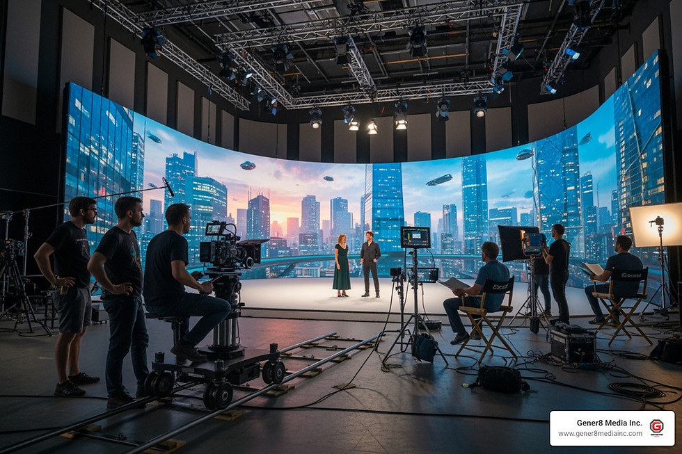
At Gener8 Media Inc., we're passionate about pushing these boundaries even further. Based here in Northern California, we've seen how our region's stunning landscapes – from coastlines to vineyards – come alive through aerial cinematography. Our expertise in virtual production and 3D animation means we don't just capture what exists; we help you envision what's possible.
Drones are no longer the future of real estate marketing – they're the present. The question isn't whether you should incorporate aerial visuals into your listings; it's whether you can afford not to. Every day you wait is another day your competition gains an edge with buyers who are increasingly expecting immersive, comprehensive visual experiences.
We leverage cutting-edge technology to transform diverse visions into immersive experiences, ensuring your properties don't just get listed – they get remembered, shared, and sold.


Comments